


-
Shirataka Kokuzo
-
Mt. Shirataka
-
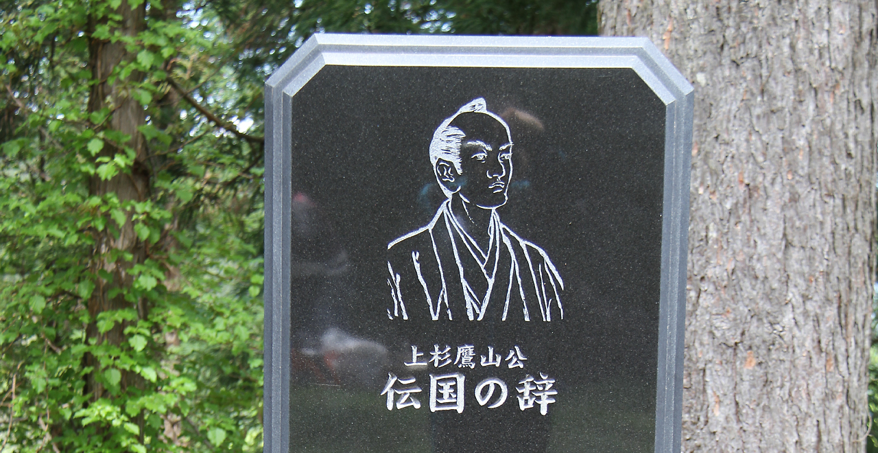
"Denkoku no Ji"―Uesugi Yozan's principles
-
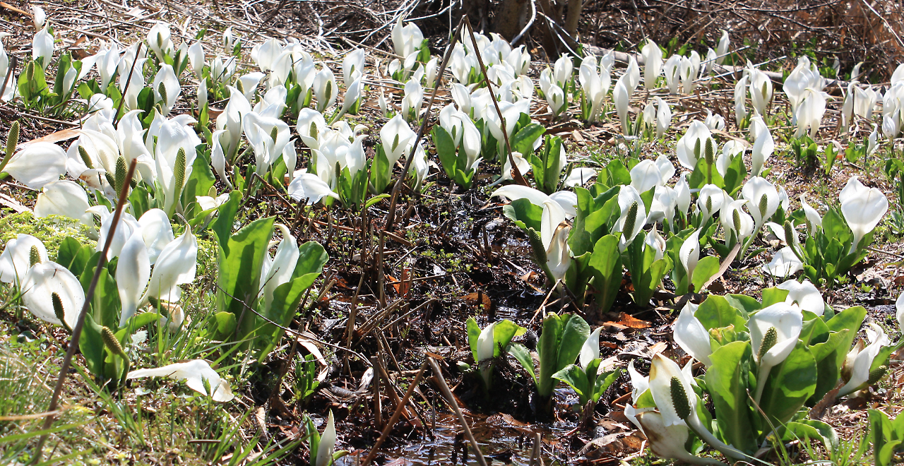
Asian skunk cabbages adding color to early spring
-
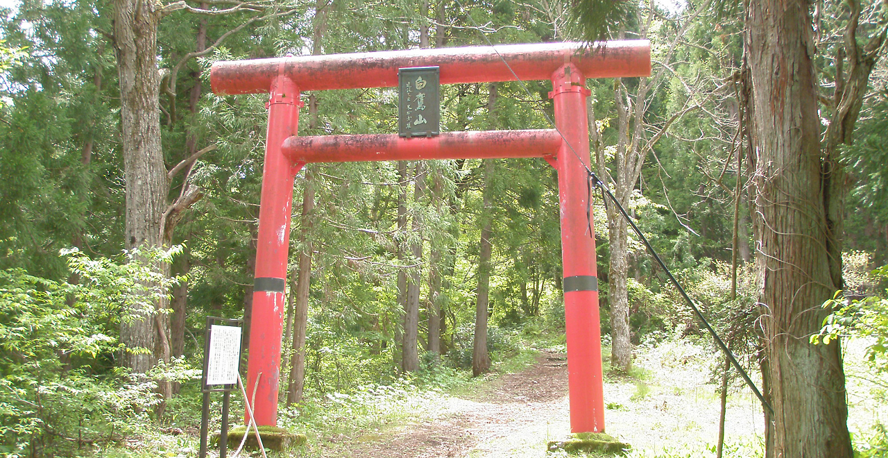
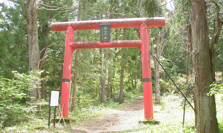
Torii gate at the Takehara Trailhead
Shirataka Kokuzo-san Recreation Forest (Mt. Shirataka)
4.10ha
Elevation Lowest: 890 m / Average: 890–994 m / Highest: 994 m
Hike on a mountain deeply associated with the feudal lord Uesugi Yozan
―"Fukuman Dai Kokuzo," one of Japan's five major Kokuzo statues―
Hike on a mountain deeply associated with the feudal lord Uesugi Yozan
―"Fukuman Dai Kokuzo," one of Japan's five major Kokuzo statues―
- Newest information
- Area
- Activities
- Overview
- Latest Information
- Usage Guide
- Facility
- Map
- Location
- Access
(Distances and times are
provided as a guide only) - Management office
contact details - Information on Other Local
Tourist Attractions - Official Tourist Information
- Recreation Forest
Management Committee - Supporters
- Other
- Newest information
- Gathering information in advance is important to safely enjoy forest recreation that brings you closer to nature.
・CHECK
・When you go out, please check local tourist and related information and gather information on road closures, weather conditions, etc.
- Area
- Tohoku
- Activities
- Flower-viewing(species:cherry,Mizubasho,Yukitsubaki) : Around Mt. Shirataka (Outside the forest) Autumn leaf viewing (Includes surrounding area) Waterfall viewing : Kuguri Falls (Outside the forest) Birdwatching : Lakes and marshes around Kenmin-no-Mori (Includes surrounding area) Picnics (lawn area/park) : Kenmin-no-Mori Central Field (Outside the forest) Fishing : Lakes and marshes around Kenmin-no-Mori(Outside the forest) Guided tours : Kenmin-no-Mori Forest Learning Center events (Outside the forest) Hands-on woodworking experience : Kenmin-no-Mori Forest Learning Center events (Outside the forest) (Payment required for use of facilities and participation in activities) Ski resort (no. of trails: 2) : Mt. Shirataka Ski Area (Outside the forest) Shrine / Temple : Kokuzo Shrine (Outside the forest)
- Overview
-
- Geographical/topographical features
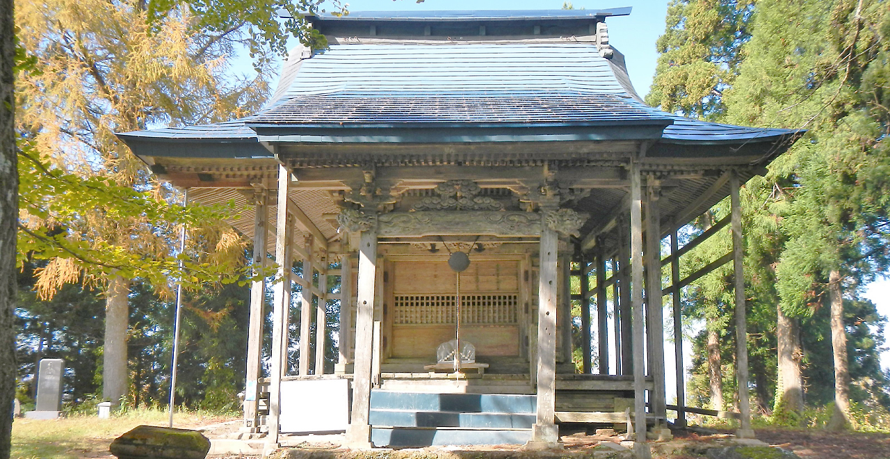
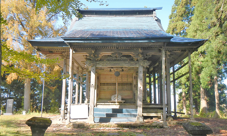
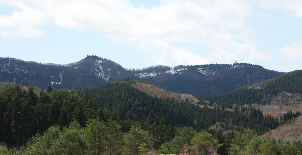
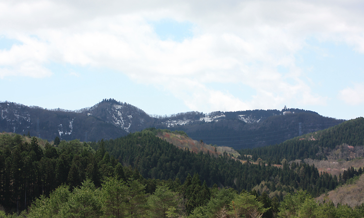
- Located within Yamagata Prefecture's Kenmin-no-Mori (a prefectural forest), Mt. Shirataka is a volcano 994 m in height straddling three municipalities: Yamanobe Town, Shirataka Town and Nanyo City. The lakes and marshes across the entirety of Kenmin-no-Mori lie at the bottom of this volcano's explosion crater and supply water to paddy fields in the surrounding areas. One of Japan's five major statues of Kokuzo (the deity of wisdom), the Fukuman Dai Kokuzo statue, is enshrined at the summit. Mt. Shirataka is a sacred mountain that represents the region.
- Historical/cultural features
- Mt. Shirataka (literally, "white hawk mountain") is said to have been named after a legend: when Gyoki, a Buddhist high priest, visited the area in the 8th century CE, a white hawk flew toward him and the Kokuzo Bosatsu appeared. Another story is that the snow-covered mountain resembles a hawk spreading its wings.
The mountain had been worshiped since ancient times by local people who believe that a god of agriculture and sericulture resides within the mountain. Uesugi Yozan (the 9th lord of the Yonezawa Domain), one of the wisest rulers of the Edo period (early 17th century to late 19th century CE), had deep faith in Mt. Shirataka and is known for instituting reforms that lowered expenses and rebuilt the domain's distressed finances. - Climate, flora and fauna
- The area has a humid subarctic climate and receives heavy snowfall as part of the Sea of Japan climate zone. Natural springs, lakes, and marshes are scattered across the base of the mountain. When the snow melts in spring, many plants and insects burst to life and become active. Visitors can see and enjoy these wonders of nature up close.
- Attractions
- In addition to being a sacred mountain long been cherished as the "High Mountain" or "Kokuzo-sama of Sakai," Mt. Shirataka has also been selected as one of the 100 Famous Yamagata Mountains. The mountain is close to Kenmin-no-Mori and offers many hiking courses, making it an attractive destination for beginner to intermediate-level trekking enthusiasts.
Hikers will first pass through the red torii gate at the Takehara Trailhead and proceed through a solemn forest with beautiful lines of cedar trees planted in commemoration of the marriage of the Showa Emperor, eventually reaching a drinking water source about half way up the mountain. Resting at this spot makes the subsequent ascent not as physically challenging, although there is a steep slope just before the summit. Hikers may encounter beautiful flowers such as Oyamazakura (Sargent's cherry (Cerasus sargentii var. sargentii)), Mizubasho (Asian skunk cabbage (Lysichiton camtschatcensis)), Yukitsubaki (Camellia rusticana Honda) and Gakuajisai (Hydrangea macrophylla) depending on the season, and can enjoy mountain trails colored with fresh green or autumn-colored Buna (Japanese beech (Fagus crenata Blume)) and other broad-leaved trees. Upon reaching the summit, hikers will find Shirataka Shrine and can also make use of a shelter with benches and a Japanese traditional fireplace as well as toilets; an attractive feature for families. Although the shrine is surrounded by a grove of old cedar trees, the summit area offers a view of the Murayama Basin as well as Mt. Chokai, Mt. Gassan and the Asahi Mountain Range in the distance.
- Latest Information
-
- Regular events
- Opening of Mt. Shirataka for the summer climbing season, Mt. Shirataka Kokuzo Festival (May 13)
- Warnings (Flora and fauna)
- Asian black bear: Tsukinowaguma (Asian black bear (Ursus thibetanus)) may be present during the period from April to November. When entering the forest, please carry a bear bell and stay in a group. Check for local information on bear sightings and warnings and follow instructions.
- Attention
- Some sections of the mountain trails require maintenance due to natural disasters, etc., so caution is required.
- Usage Guide
-
- Entrance fee
- Free
- Operating hours and seasons
- Accessible 24 hours a day, 365 days a year. However, in practice, the Recreation Forest cannot be used during the winter as snow is removed only up to a point just before the trailhead.
- Accommodation options
- EKenmin-no-Mori Campsite
- Facility
- Toilets (Outside the forest) Walking trail (Includes surrounding area) Bike trail (Outside the forest) Parking lot (Outside the forest) Vending machine (Outside the forest) Campsite and/or cabins (Outside the forest) Resource center (Outside the forest)
- Map
- Location
- Kokuzo and other areas of Hataya, Yamanobe Town, Higashi-Murayama County, Yamagata Prefecture()()
- Access
(Distances and times are provided as a guide only) -
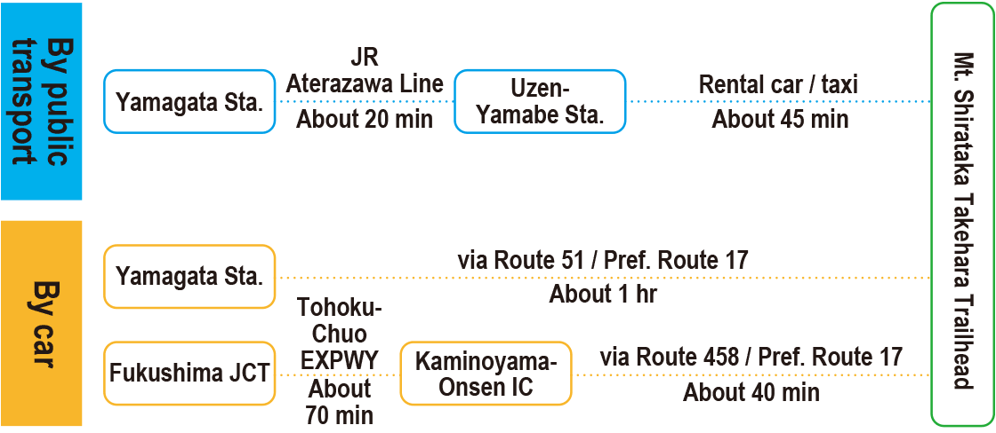
-
Parking lot capacity / parking charges- Takehara Trailhead Parking Lot: Free parking for 8 vehicles
- Nearby tourism facilities
- ・Site of Hataya Castle (about 3 km / 10 minutes by car)
- ・Kenmin-no-Mori Forest Learning Center (about 3 km / 10 minutes by car)
- Management office contact details
-
Yamagata District Forest OfficeTEL:0237-86-3161
https://www.rinya.maff.go.jp/tohoku/syo/yamagata/index.html
- Information on Other Local Tourist Attractions
-
Yamagata-ken Kenmin-no-Mori [External link]
- Official Tourist Information
-
Yamanobe Town Tourism Association [External link]Yamagata-Yama [External link]
- Recreation Forest Management Committee
- ー
- Supporters
- ー
- Other
- ー
PDF形式のファイルをご覧いただく場合には、Adobe Readerが必要です。
Adobe Readerをお持ちでない方は、バナーのリンク先からダウンロードしてください。
![]()