


-
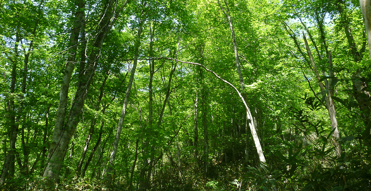
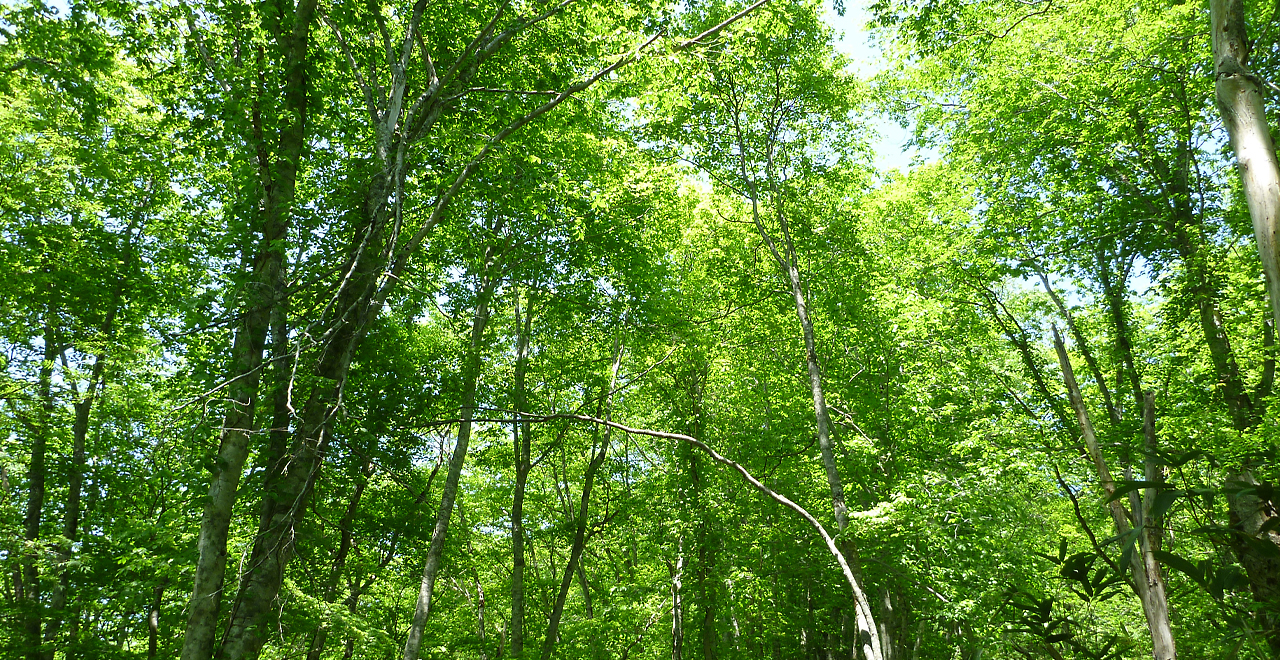
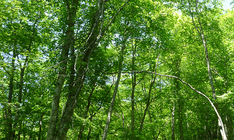
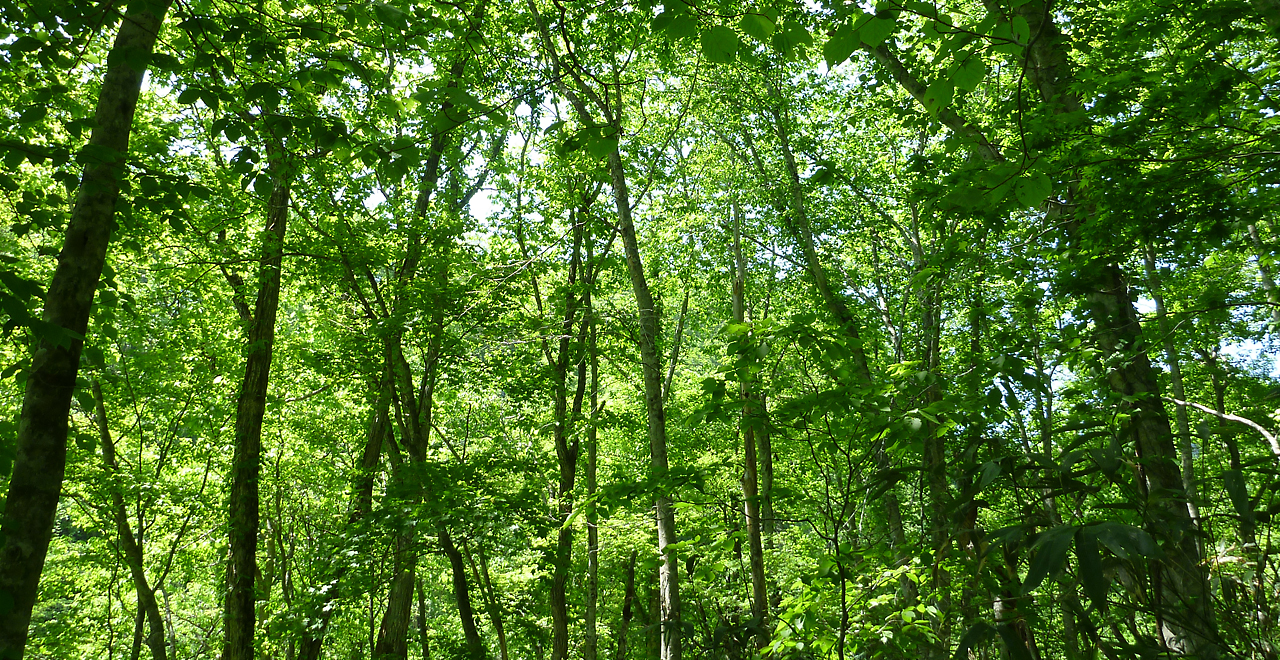
Fresh verdure in the forest
-
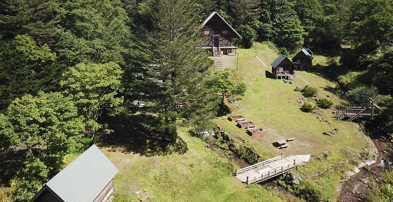
View from above
-
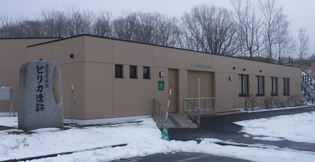
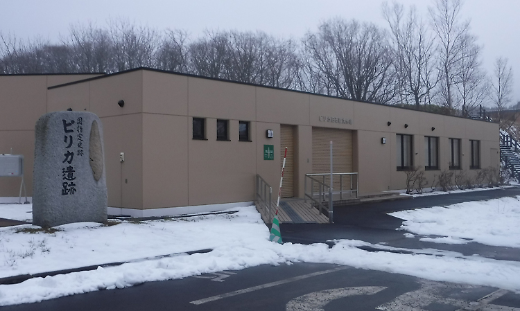
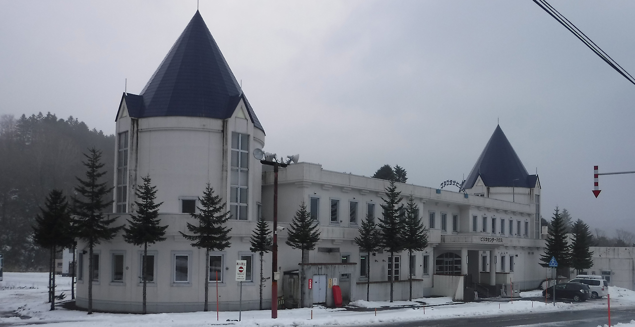
Pirika Paleolithic Culture Museum
-
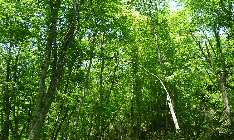
Japanese beech grove in spring
-
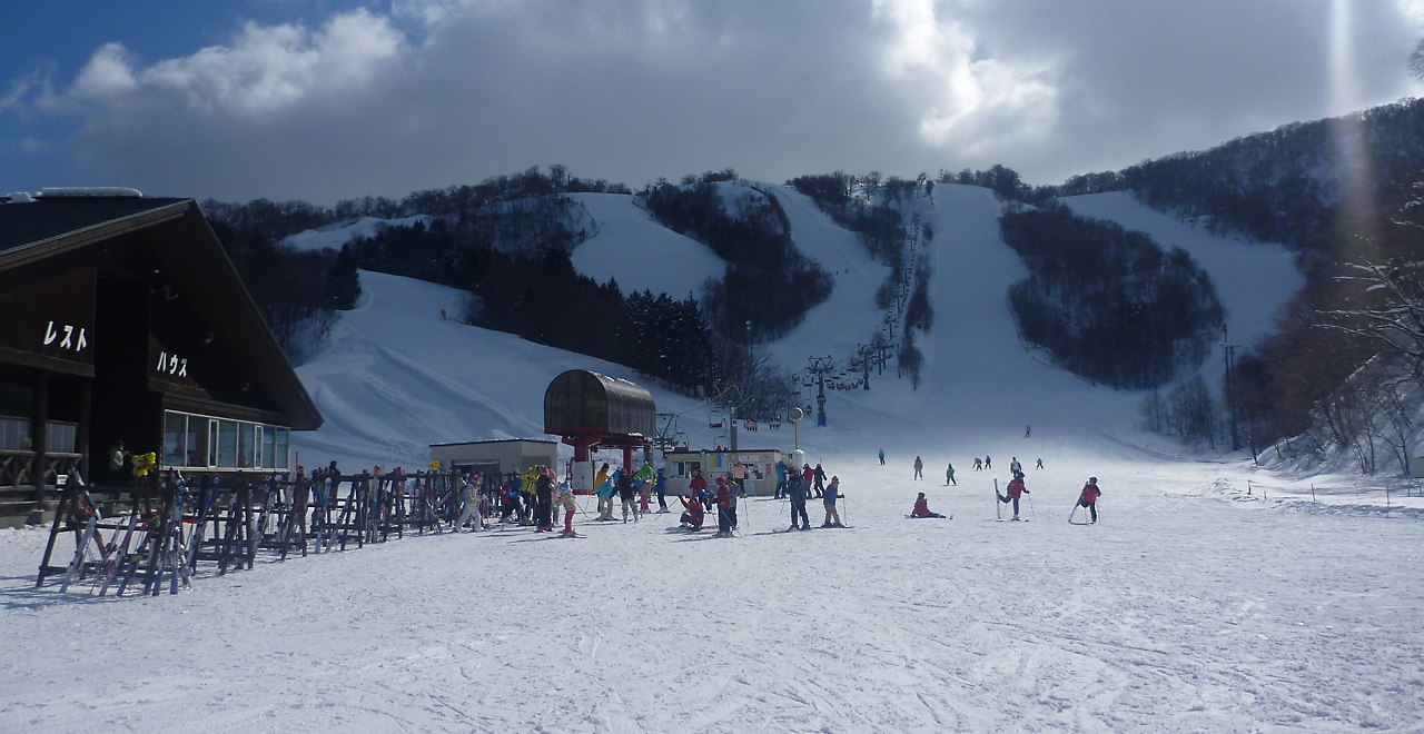
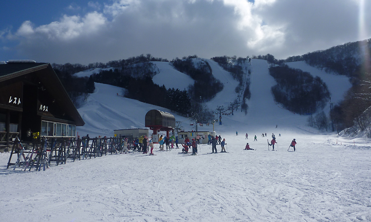
Pirika Ski Area
-
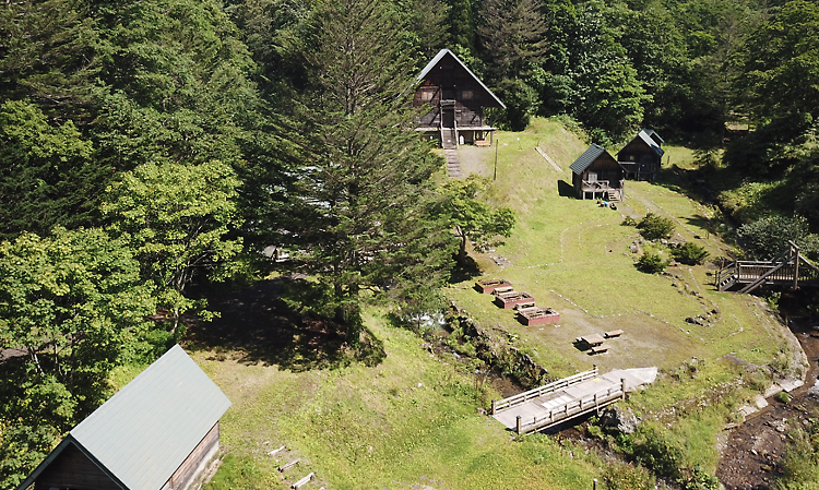
Kur Plaza Pirika
-
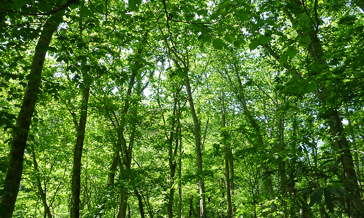
Lush greenery
Pirika & Futamata Recreation Forest
709.87ha
Elevation Lowest: 160 m / Average: 160–674 m / Highest: 674 m
Savor magnificent views along a walking trail
through a vast primeval Japanese beech forest!!
Savor magnificent views along a walking trail
through a vast primeval Japanese beech forest!!
- Newest information
- Area
- Activities
- Overview
- Latest Information
- Usage Guide
- Facility
- Map
- Location
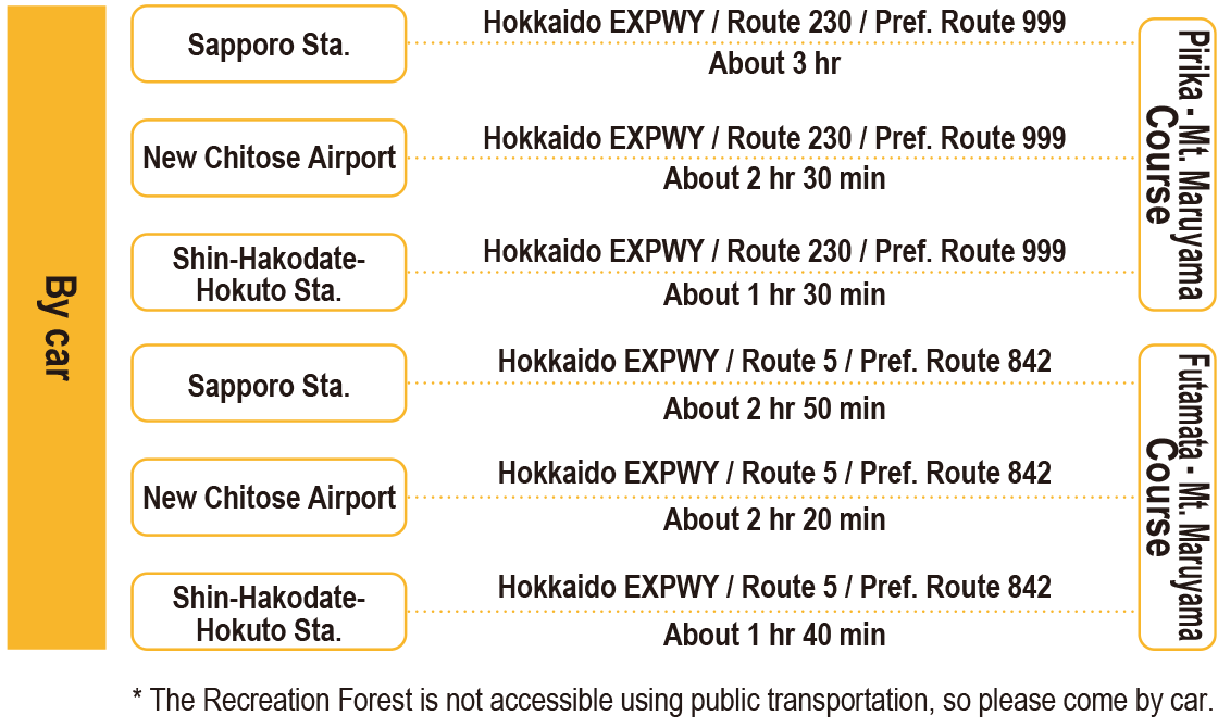
- Access
(Distances and times are
provided as a guide only) - Management office
contact details - Information on Other Local
Tourist Attractions - Official Tourist Information
- Recreation Forest
Management Committee - Supporters
- Other
- Newest information
- Gathering information in advance is important to safely enjoy forest recreation that brings you closer to nature.
・CHECK
・When you go out, please check local tourist and related information and gather information on road closures, weather conditions, etc.
- Area
- Hokkaido
- Activities
- Birdwatching (Includes surrounding area) Picnics (lawn area/park) :Pirika Dam (Outside the forest) Paddling / fishing / boating (pond / lake / river) (Outside the forest) Ski resort (no. of trails: 4) : Pirika Ski Area (Outside the forest)
- Overview
-
- Geographical/topographical features
- The Recreation Forest, located almost in the middle of the Oshima Peninsula, lines both sides of a ridge of relatively low mountains running north-south along the spine of the peninsula. The summit of Mt. Maruyama offers a rare view of both the Pacific Ocean to the east and the Sea of Japan to the west. The Oshamambe River flows east toward the Pacific Ocean into the Uchiura Bay, while the limpid Shiribeshi-Toshibetsu River flows west toward the Sea of Japan, forming a belted plain.
- Historical/cultural features
- The name of the Pirikabetsu River is derived from the Ainu language word "pirika," meaning "good," "beautiful" and "affluent."
The nearby Pirika Paleolithic Culture Museum displays a large number of stone tools excavated in Imakane Town, mainly in the Pirika area. The museum’s various hands-on activities, including classes where visitors can learn to make arrowheads or magatama (comma-shaped beads), are also recommended. - Climate, flora and fauna
- The area has a moderate climate for Hokkaido. However, it has the Sea of Japan climate in the winter, receiving heavy snowfall and strong westerly winds.
The area forms a natural forest with a mix of broad-leaved trees, mainly Buna (Japanese beech (Fagus crenata Blume)), Mizunara (Japanese oak mizu-nara (Quercus crispula Blume), Itaya Kaede (Acer pictum Thunb. subsp. dissectum (Wesm.) H.Ohashi) and birch. - Attractions
- The entire area consists of a forest of deciduous broad-leaved trees, mainly Japanese beech. The natural Japanese beech forest and other natural features, such as mountain streams, create a picturesque atmosphere and a great chance to observe and appreciate the area’s plant life.
The Recreation Forest is also home to many wild birds, including Yamagera (grey-headed woodpecker (Picus canus)), Akagera (great spotted woodpecker (Dendrocopos major)) and Uguisu (Japanese bush warbler (Horornis diphone)). Visitors can take a refreshing stroll in the forest amid the birdsong and engage in birdwatching.
The forest is popular among locals due to its accessibility and natural beauty and attracts large numbers of vacation campers over the Golden Week and summer holidays.
Two mountain trails lead to Mt. Maruyama. The 2.8 km long "Pirika - Mt. Maruyama Course" takes about 1 hour and 50 minutes and is also suitable for families. The 6 km "Futamata - Mt. Maruyama Course" takes about 2 hours and 30 minutes and includes a long, steep climb to the summit, so it is appropriate for more physically fit walkers. The Mt. Maruyama Observation Platform at the summit offers a superb panoramic view of various famous mountain peaks, such as Mt. Yotei and Mt. Usu, and the Sea of Japan. Isolated Mt. Yotei is known to locals as "Ezo Fuji" (Mt. Fuji of Hokkaido) for its graceful shape. Hot spring accommodation facilities are available along the national highway about 10 km before the Pirika - Mt. Maruyama Course Trailhead and also at the Futamata - Mt. Maruyama Course Trailhead. - Other
- The Pirika area and its surroundings offer excellent fishing and attract fishing enthusiasts from all over Japan. The Shiribeshi-Toshibetsu River―ranked as having the best water quality in Japan―and its tributaries contain abundant wild Ayu (Ayu sweetfish), Yamame (masu salmon), Iwana (Japanese char) and Nijimasu (rainbow trout). Visitors can also go rafting and gold panning in these rivers.
- Latest Information
-
- Warnings(Flora and fauna)
- Ezo Brown bears: Higuma (brown bears (Ursus arctos)) may be present. When entering the forest, please carry a bear bell and stay in a group. Check for local information on bear sightings and warnings and follow instructions.
Ticks: Please note that ticks are present in the underbrush. Wearing long sleeves and long trousers is essential.
- Usage Guide
-
- Entrance fee
- None for the Recreation Forest itself
- Operating hours and seasons
- Basically accessible 24 hours a day.
However, the forest road on the Okupirika Onsen side (the hot spring is currently closed) becomes impassable from October through May.
(The specific period during which the road is impassable depends on snowfall.) - Accommodation options
- Hotels, Japanese inns and guest houses in Imakane Town
Onsen hotels, Japanese inns, and guest houses in Oshamambe Town
- Facility
- Toilets and drinking fountains (Outside the forest) Walking trail (Includes surrounding area) Parking lot (Includes surrounding area) Observation platform Vending machine : Futamata Radium Onsen・Kur Plaza Pirika(Outside the forest) Shop : Futamata Radium Onsen・Kur Plaza Pirika (Outside the forest) Restaurant : Kur Plaza Pirika (Outside the forest) Campsite and/or cabins : Pirika Dam (Outside the forest) Resource center/Museum : Pirika Paleolithic Culture Museum (Outside the forest) Accommodation facilities (Hotels/Japanese inns) : Kur Plaza Pirika (Outside the forest) Hot Spring : Kur Plaza Pirika (Outside the forest)
- Map
- Location
- Imakane Town, Setana County /
Oshamambe Town, Yamakoshi County, Hokkaido
- Access
(Distances and times are provided as a guide only) -
-
Parking lot capacity / parking charges- - Okupirika Onsen (The onsen (hot spring) is currently closed, but parking is available.)
(Pirika - Mt. Maruyama Course Trailhead): Free parking for 10 ordinary vehicles - - Futamata Radium Onsen
(Futamata - Mt. Maruyama Course Trailhead): Free parking for 10 ordinary vehicles
- - Okupirika Onsen (The onsen (hot spring) is currently closed, but parking is available.)
- Nearby tourism facilities
- [Imakane Town side]
- - Pirika Onsen "Kur Plaza Pirika"
Kur Plaza Pirika is an onsen hotel located at the foot of a mountain opposite the Pirika Dam. The adjacent Pirika Ski Area has four fun ski trails (night skiing available) appropriate for everyone from beginners to experts. The snow here is reputedly the best quality snow in southern Hokkaido for skiing. Skiers can also bathe in the hot springs here immediately after skiing.
In the summer, visitors can rent all the gear they need as part of an all-inclusive camping package and camp without having to bring any gear with them. Camping spaces (fee required) are also available for campers who bring their own gear. Campers can even partake in an optional BBQ dinner set that includes Imakane Black Wagyu beef, a rare local delicacy. For details, please see Kur Plaza Pirika's website (http://kurplazapirika.net/).
- - Pirika Paleolithic Culture Museum
This museum is a tourist information facility for the National Historic Site Pirika. It has a Paleolithic Era exhibition room with a large-screen video corner and a display of important cultural properties, and a hands-on activity room offering stone tool-making activities.
- [Oshamambe Town side]
- - Futamata Radium Onsen
Futamata Radium Onsen is a famous therapeutic onsen. The 25 m high travertine dome is one of the two largest in the world, the other being the travertine terraces in Yellowstone National Park in the United States.
- Management office contact details
-
Oshima District Forest Office
- Information on Other Local Tourist Attractions
-
Kur Plaza Pirika's website [External link]
- Official Tourist Information
-
Imakane Town website [External link]Oshamambe Town website [External link]
- Recreation Forest Management Committee
-
Pirika & Futamata Recreation Forest Management Committee / Imakane Municipal OfficeTEL : 0137-82-0111
- Supporters
- ー
- Other
- ー
PDF形式のファイルをご覧いただく場合には、Adobe Readerが必要です。
Adobe Readerをお持ちでない方は、バナーのリンク先からダウンロードしてください。
![]()