


-
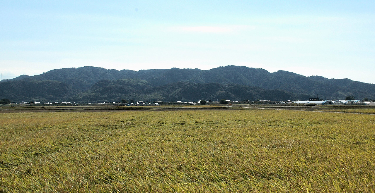
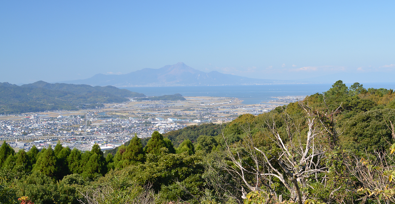
Panorama of Mt. Kihara
-
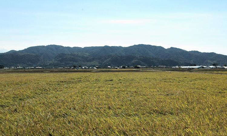
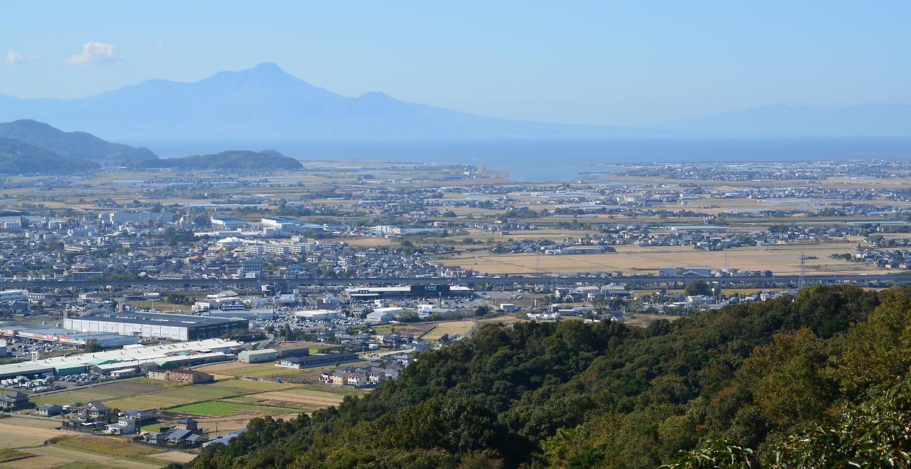
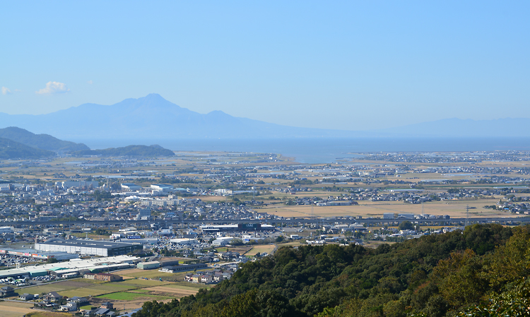
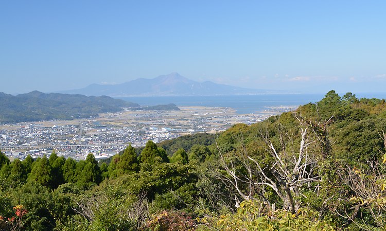
View of Mt. Kihara from the city
-
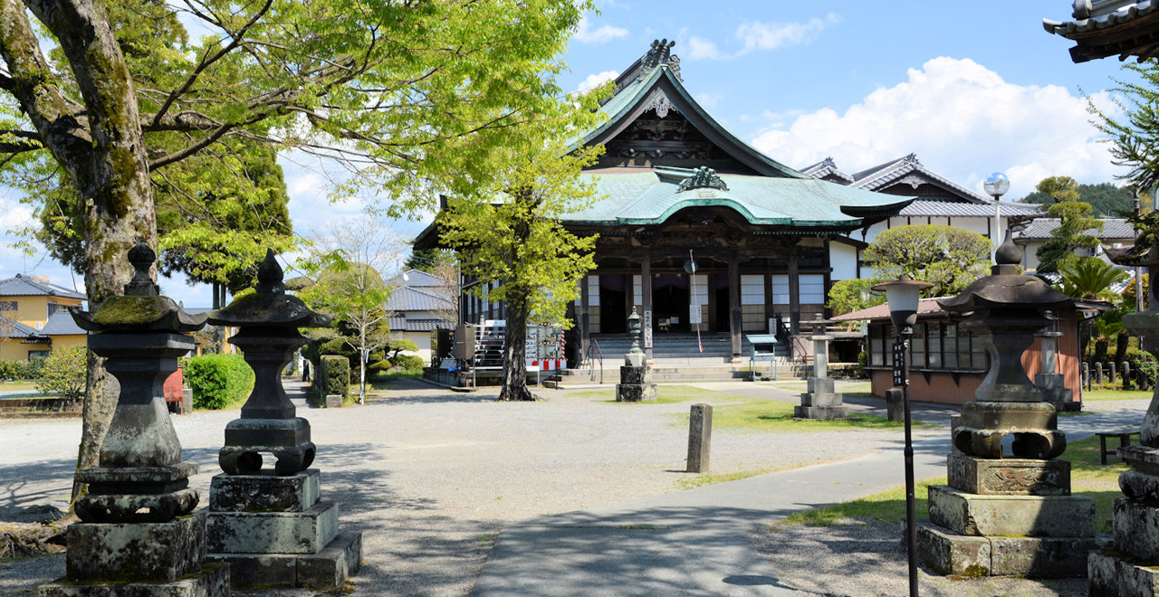
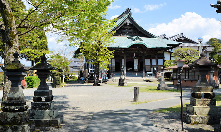
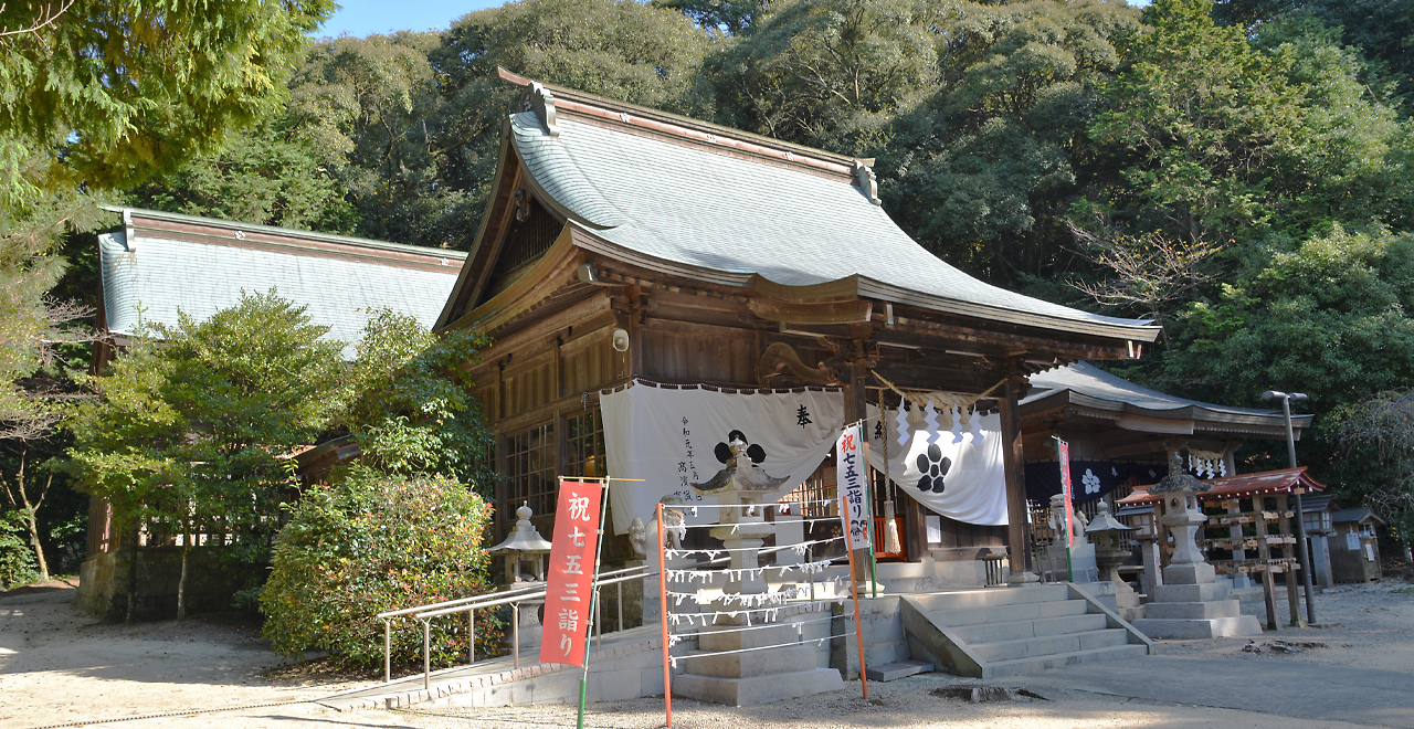
Kihara Fudoson Temple, known for its fire-walking ritual
-
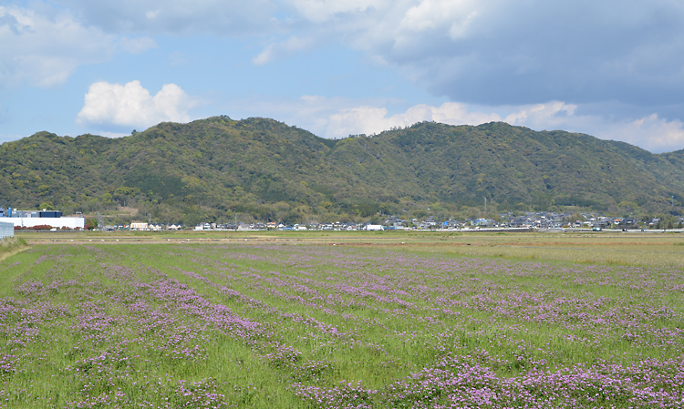
View of Mt. Fugen from the Nyorai-ji Temple Course
-
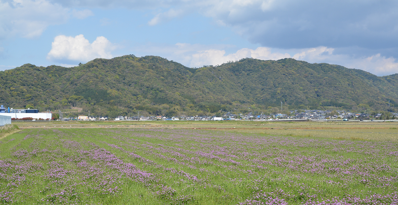
Mt. Fugen in the distance
-
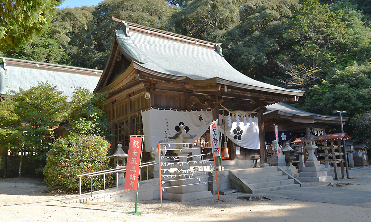
Rokuden Shrine
Kihara-yama Recreation Forest (Mt. Kihara / Mt. Gankai)
57.85ha
Elevation Lowest: 50 m / Average: 50–300 m / Highest: 314 m
Mt. Gankai―rooted in the local community and the site of several historical events
Mt. Gankai―rooted in the local community and the site of several historical events
- Newest information
- Area
- Activities
- Overview
- Latest Information
- Usage Guide
- Facility
- Map
- Location
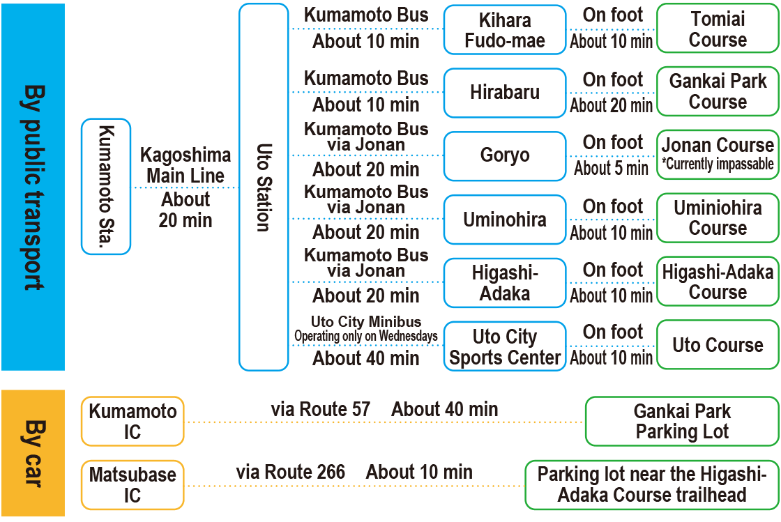
- Access
(Distances and times are
provided as a guide only) - Management office
contact details - Information on Other Local
Tourist Attractions - Official Tourist Information
- Recreation Forest
Management Committee - Supporters
- Other
- Newest information
- Gathering information in advance is important to safely enjoy forest recreation that brings you closer to nature.
・CHECK
・When you go out, please check local tourist and related information and gather information on road closures, weather conditions, etc.
- Area
- Kyusyu
- Activities
- Flower-viewing : Tachioka Nature Park (cherry (Prunus)) (Outside the forest) Paddling / fishing / boating (pond / lake / river) : Tachioka (Outside the forest) Shrine / Temple (Outside the forest) Natural monuments (nationally designated) : Icho (ginkgo (Ginkgo biloba)) in Shimoda (Outside the forest)
- Overview
-
- Geographical/topographical features
- Mt.Kihara, located in central Kumamoto Prefecture, straddles Kumamoto City, Uto City and Uki City. From the foot of Mt. Kihara to its 314 m summit, it forms an oblong hill stretching in an east-west direction. Mt. Kihara is considered to constitute the base of the Uto Peninsula, and its bedrock is made up of sedimentary rocks of sandstone and conglomerate from the late Cretaceous period.
- Historical/cultural features
- It has been said that, in the 12th century, Chinzei Hachiro Minamoto no Tametomo lived in a castle built on Mt. Kihara. Tametomo was an uncle of Minamoto no Yoritomo, who founded the Kamakura shogunate, and father of Shunten, the first king of the Ryukyu Islands. Young Tametomo was extremely rough, causing his father Tameyoshi to send him to Kyushu at the age of 13. However, he later built a castle on Mt. Kihara in Higo Province (current Kumamoto) and married a daughter of Tadakuni, the supreme priest of Aso Shrine. He then conquered Kyushu and retitled himself Chinzei Hachiro ("Chinzei" referring to Kyushu).
According to legend, Tametomo was also a renowned master of the bow, and was always shooting down "gan" (geese) flying over Mt. Kihara with a powerful bow. The geese became frightened and began to detour around Mt. Kihara to avoid flying over it, and that is why the mountain came to be called "Mt. Gankai" (geese detour mountain). Even today, the mountain is fondly called "Mt. Gankai" by the people of Kumamoto. - Climate, flora and fauna
- The annual average temperature is about 17°C, and the climate is mild and comfortable all year round. Nousagi (Japanese hare (Lepus brachyurus)) and wild birds can be found along the footpaths, and the forest is covered with evergreen broad-leaved trees such as Shii (chinquapin (Castanopsis)), Kashi (evergreen oak (Quercus)) and Tabu (Machilus thunbergii) as well as planted Sugi (Japanese cedar (Cryptomeria japonica)) and Hinoki (Japanese cypress (Chamaecyparis obtuse)). The forest is cherished by locals as a place for relaxation and recreation.
- Attractions
- The observation platform provides a superb view over the Midori River with its abundant water flowing through the countryside of the Kumamoto Plain and into Shimabara Bay. Visitors can also take in a panoramic view of the foot of Mt. Kinbo and the urban area of Kumamoto City in the north, the smoldering peaks of Aso in the east, the Yatsushiro Plain in the south and the islands of Amakusa in the sea to the west.
There are 6 hiking courses to the summit, so hikers can enjoy hiking on Mt. Kihara from many directions. It takes about 1 hour of easy, pleasant hiking to reach Observation Platform No. 1. Along the way, hikers can see a statue of Fudo, a mossy artificial waterfall where many Jizo statues stand in an unusual atmosphere, Oni No Iwaya (ogre's grotto)―the site of many legends, and an unusually shaped tree whose branches grow vertically, like mini-trees, from the middle of a horizontal branch.
There are a variety of historical spots at the foot of the mountain, such as Kihara Fudoson Temple―one of Japan's three major Fudoson temples. The vermilion "romon" gate of Rokuden Shrine became Kumamoto Prefecture's first important cultural property. Tsukawara Old Tomb Park is one of Japan's largest burial mound sites, and the Goryo Kaizuka Archaeological Site is a nationally designated historical site.
- Latest Information
-
- Regular events
- Kihara Fudoson Temple Spring Festival (February)
Rokuden Shrine Autumn Festival (October) - Warnings (Flora and fauna)
- Beware of ticks and wasps, which are active from spring through autumn. Wearing long sleeves and long trousers is recommended.
- Warnings (Dangerous areas)
- Please be careful of the electrified fences set up to stop Inoshishi (wild boar (Sus scrofa leucomystax)).
- Usage Guide
-
- Entrance fee
- Free
- Operating hours and seasons
- Accessible 24 hours a day, 365 days a year
- Accommodation options
- [Outside the forest]
Tachioka Nature Park Campsite, many accommodation facilities in the urban area of Kumamoto City
- Facility
- Toilets (Includes surrounding area) Walking trail (Includes surrounding area) Parking lot (Includes surrounding area) Observation platform Vending machine (Outside the forest) Shop (A convenience store nearby) (Outside the forest) Restaurant (Outside the forest) Campsite and/or cabins : Tachioka Nature Park (Outside the forest) (Payment required in some cases) Free public wireless LAN (Wi-Fi) (Outside the forest) Resource center : Kumamotoshi Tsukawara Museum (Outside the forest) (Payment required for use of facilities and participation in activities) Cultural Property (nationally designated) : Rokuden Shrine (romon gate) (Outside the forest) Accommodation facilities (Hotels/Japanese inns) (Outside the forest) Hot Spring : Jonan Onsen (hot spring) (Outside the forest)
- Map
- Location
- Tomiaimachi-Kiwara, Minami Ward, Kumamoto City; Hanazonomachi / Iwakosomachi, Uto City, Kumamoto Prefecture
- Access
(Distances and times are provided as a guide only) -
-
Parking lot capacity / parking charges- 3 parking lots (parking lots of public facilities are also available)
- Nearby tourism facilities
- - Kihara Fudoson Temple / Rokuden Shrine (about 15 minutes on foot from Kumamoto Bus Kihara Fudo-mae Bus Stop)
- - Kumamoto General Rail Yard (about 20 minutes on foot from JR Tomiai Station)
- - Okoshiki Beach (30 minutes by car from Mt. Gankai)
- Management office contact details
-
Kumamoto District Forest OfficeTEL:0968-25-2101
- Information on Other Local Tourist Attractions
-
ー
- Official Tourist Information
-
Kumamoto City Official Guide [External link]
- Recreation Forest Management Committee
-
Mt. Gankai Area Development Liaison CommitteeGeneral Affairs and Planning Division, kumamoto Municipal Office
TEL:096-357-4112
FAX:096-358-0110
- Supporters
- ー
- Other
- ー
PDF形式のファイルをご覧いただく場合には、Adobe Readerが必要です。
Adobe Readerをお持ちでない方は、バナーのリンク先からダウンロードしてください。
![]()