


-
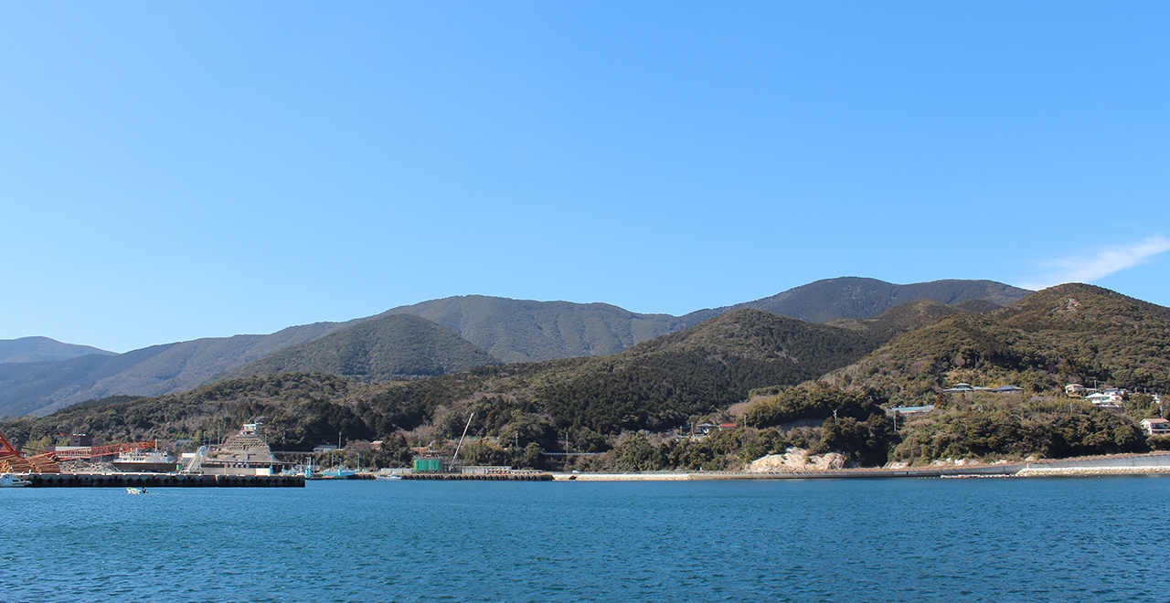
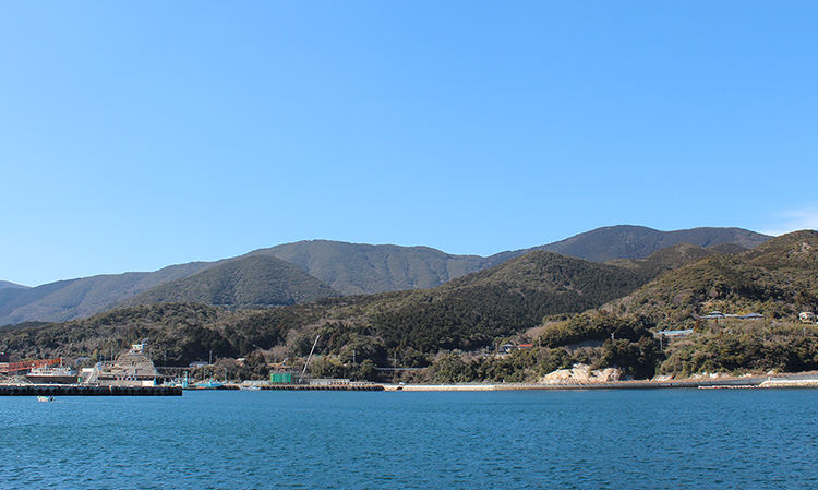
View of Mt. Ariake from the sea
-
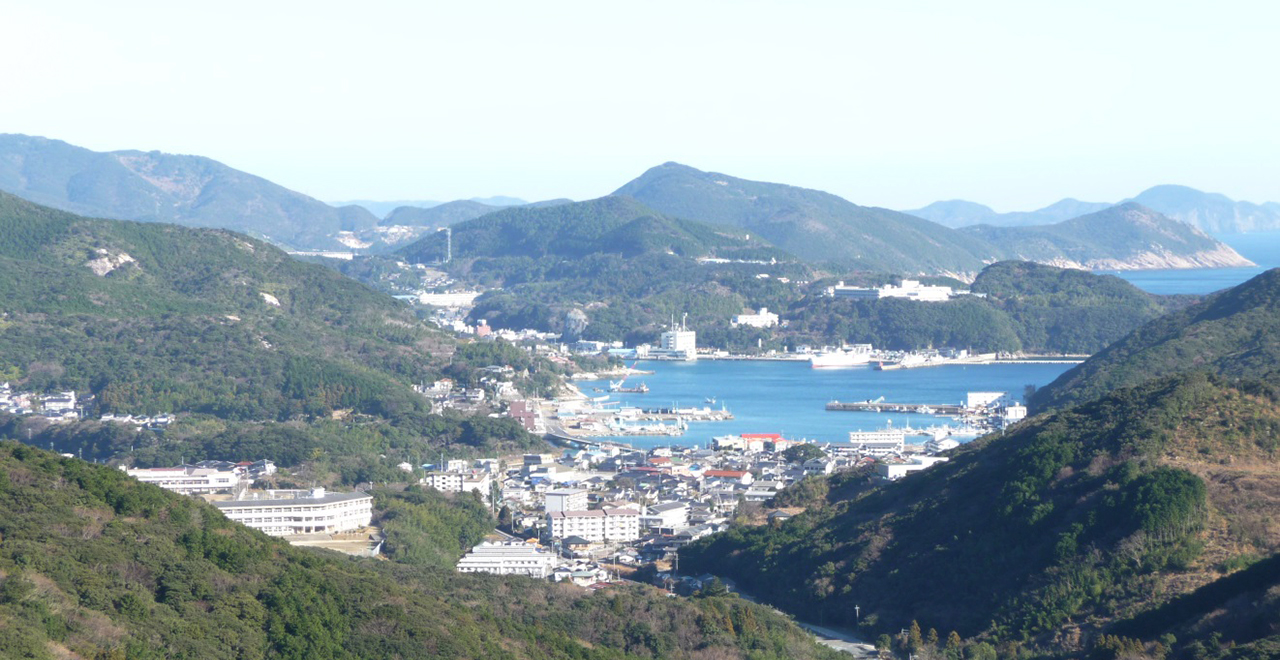
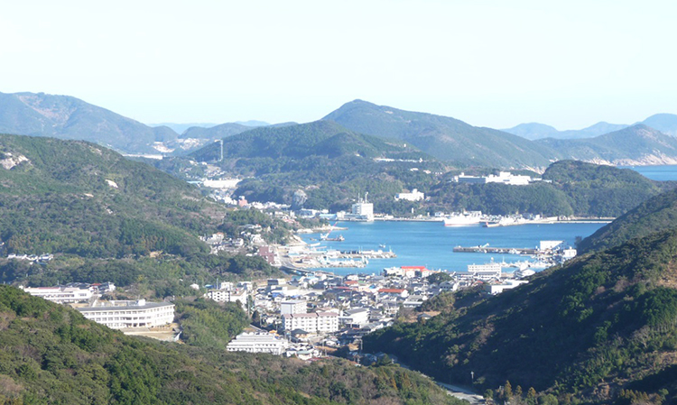
Overlooking the Izuhara city area from the Ariake-yama (Mt. Ariake) Recreation Forest
-
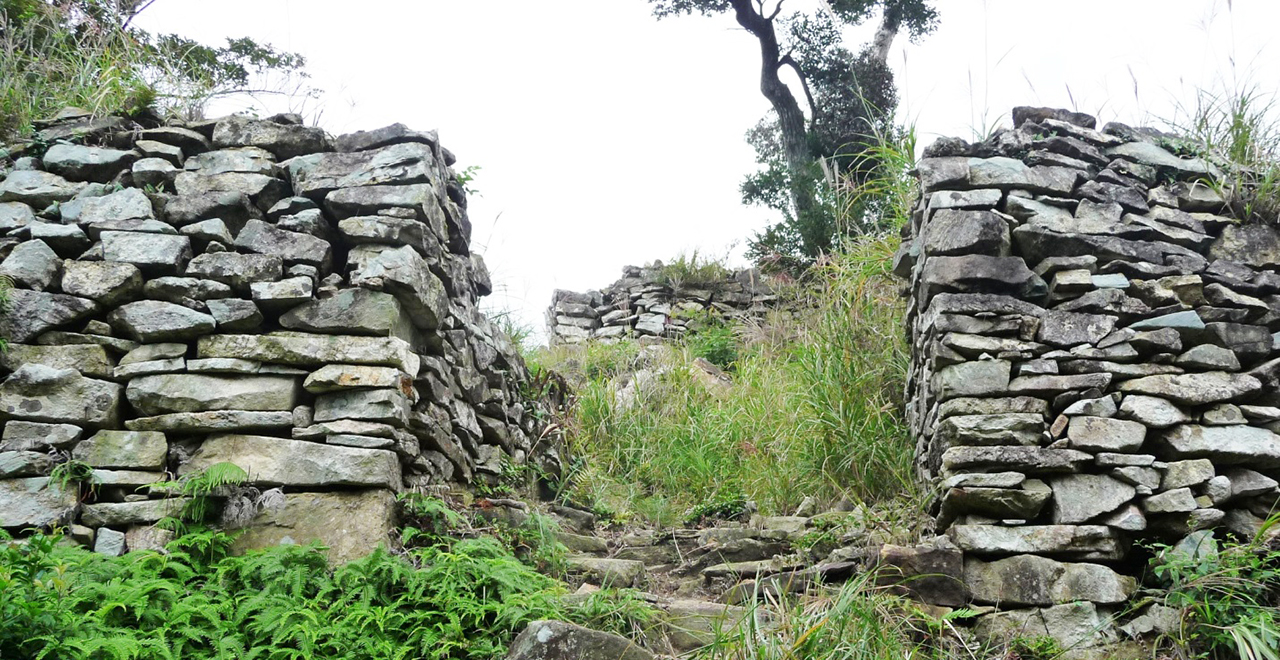
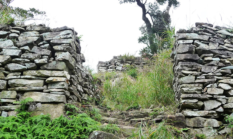
Ruins of the Shimizuyama Castle
-
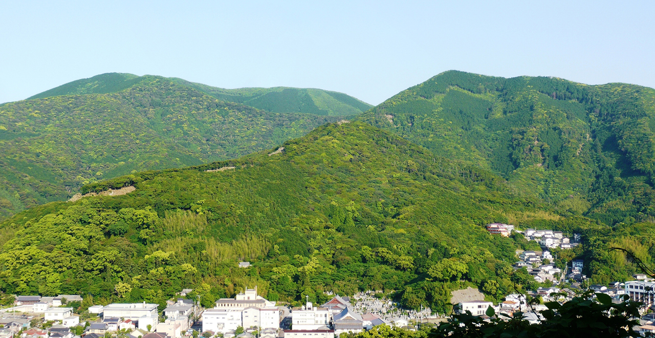
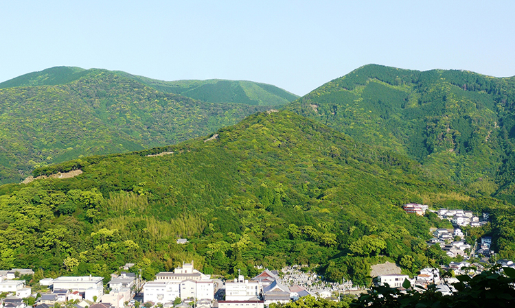
Mt. Ariake covered in fresh, early-summer verdure
-
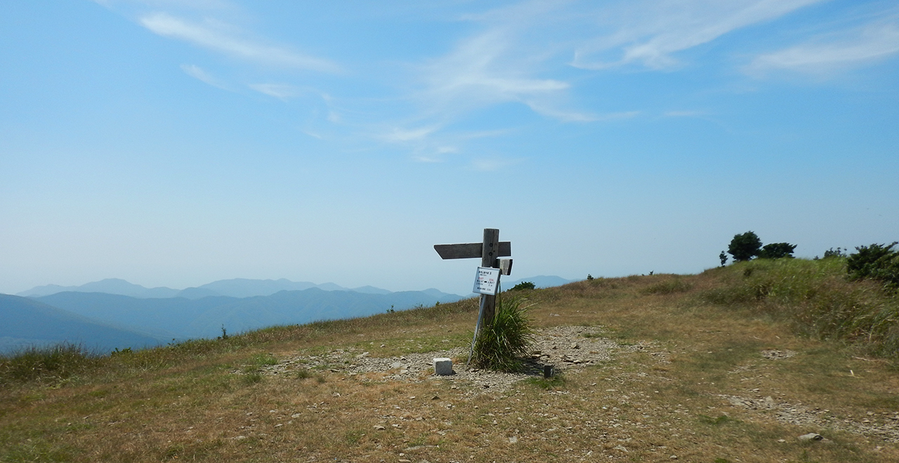
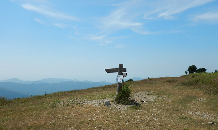
Mt. Ariake summit
-
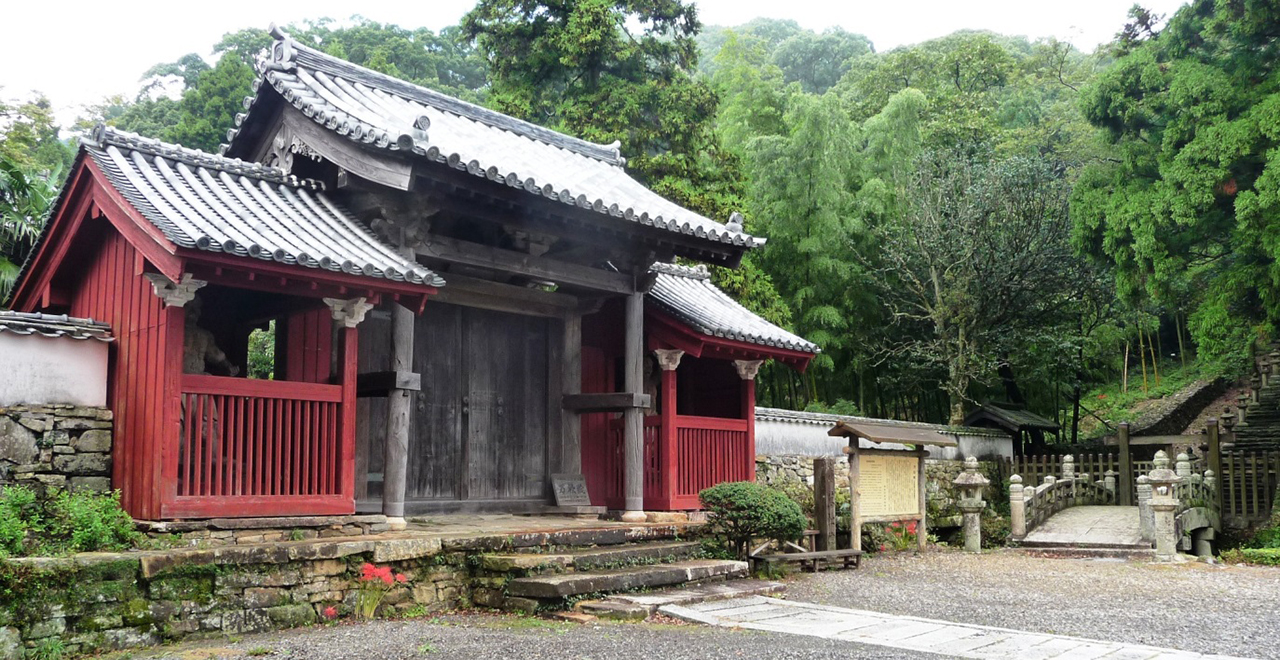
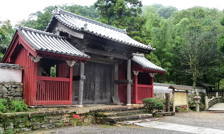
Bansho-in Temple
Ariake-yama (Mt. Ariake) Recreation Forest
59.77ha
Elevation Lowest : 120m / Average : 200–400m / Highest : 558m (Mt. Ariake summit)
Mt. Ariake on the island of Tsushima ― Feel the nature and long history of a border island
Mt. Ariake on the island of Tsushima ― Feel the nature and long history of a border island
- Newest information
- Area
- Activities
- Overview
- Latest Information
- Usage Guide
- Facility
- Map
- Address
- Access
(Distances and times are
provided as a guide only) - Management office
contact details - Information on Other Local
Tourist Attractions - Official Tourist Information
- Recreation Forest
Management Committee - Supporters
- Other
- Newest information
- Gathering information in advance is important to safely enjoy forest recreation that brings you closer to nature.
・CHECK
・When you go out, please check local tourist and related information and gather information on road closures, weather conditions, etc.
- Area
- Kyushu
- Activities
- Flower-viewing (species: Genkaitsutsuji (Rhododendron mucronulatum ciliatum (Rhododendron mucronulatum Turcz. var. ciliatum Nakai))) (Includes surrounding area) Autumn leaf viewing (Includes surrounding area) Birdwatching (Includes surrounding area) Picnics (lawn area/park) Mountain climbing (Includes surrounding area) Bicycle rental (Outside the forest) Guided tours (Includes surrounding area) (Payment required in some cases) Shrine / Temple visit (Outside the forest) (Payment required for use of facilities and participation in activities) : Bansho-in Temple
- Overview
-
- Geographical/topographical features
- The Recreation Forest is located in a hilly area of Ariake Mountains in the southern part of the island of Tsushima. Small peaks form a row with Mt. Ariake at the center, and the topography is relatively steep except for the summit part. Mt. Ariake is the largest mountain you can see in front of you when you are bound for Izuhara Port by ferry. The summit part is a flat grassland where you can relax and eat lunch or take a break. It overlooks the ruins of the Shimizuyama Castle and the town of Izuhara, and the summit commands a view of Mt. Yatate (648 m), Mt. Shiratake (515 m), and the scenic Aso Bay with the complicated coastline of the ria coast.
- Historical/cultural features
- Poem No. 3,516 in Manyoshu (Collection of Ten Thousand Leaves) Vol. 14 is a poem read by a Sakimori guard (Sakimori guards are soldiers who were gathered from distant areas to guard northern Kyushu (Tsushima, Iki, and Fukushima) after the Battle of Baekgang with the Korean Peninsula in 633), which says as follows: the peak in Tsushima is low, so there are no clouds under it; so I will look at the clouds trailing over a god-dwelling peak and think of you. This poem describes the scene where Sakimori guards who have left their hometown think about their families and loved ones they have left behind. The "peak in Tsushima" read in the poem is not necessarily Mt. Ariake, but as it is the mountain that looks the largest when seen from the Izuhara Port, it can well be referring to Mt. Ariake.
Since those times, Tsushima had had important relationships with neighboring countries as a "border island" at the forefront of the battle lines, but after diplomatic relations were restored, it served as an island of friendship.
The Recreation Forest overlooks the ruins of the Shimizuyama Castle, which is said to have been built by Toyotomi Hideyoshi when dispatching troops to Korea in 1591. It was a nationally unique mountain castle structured in steps, and its ruins have been designated a national historic site. Many remains that remind us of old-day Tsushima are found in the vicinity, including Bansho-in Temple (nationally designated historic site) ―the family temple of the So Clan, the Shugodai (deputy military governor) of the Tsushima Domain, with a 100,000 koku stipend―which is counted as one of Japan's three largest cemeteries along with the Maeda Clan Cemetery in Ishikawa Prefecture and the Mori Clan Cemetery in Yamaguchi Prefecture. The turbulent border island Tsushima, which has changed over time, draws attention as a historically and culturally valuable place. - Climate, flora and fauna
- From late March to April, on sunny ridges and near the summit, Genkaitsutsuji (Rhododendron mucronulatum ciliatum (Rhododendron mucronulatum Turcz. var. ciliatum Nakai)) gives bloom to a couple of vivid rose-pink flowers at the tip of each branch before the leaves come out, and add breath-taking colors to the lonely scenery that has withered in winter. Around that time, pretty flowers such as Fuderindo (Gentiana zollingeri Fawc.) and Shihaisumire (Viola violacea Makino var. violacea) bloom near the ground, and herald the spring in Tsushima. During the early-summer rainy season, the white flowers of Yamaboshi (Japanese dogwood (Cornus kousa Buerger ex Hance subsp. kousa)) are at their best.
The mountain trail runs through a planted forest of Hinoki (Japanese cypress (Chamaecyparis obtuse)) at some places, but a laurel forest consisting of Sudajii (Castanopsis sieboldii (Makino) Hatus. ex T.Yamaz. et Mashiba), Yabutsubaki (Japanese camellia (Camellia japonica)), and Akagashi (Japanese evergreen oak (Quercus acuta)) also remains, and Aridoshi (Damnacanthus indicus Gaertn. f.) can be frequently seen on the forest floor. The planted Japanese cypress has a distinctively characteristic color and scent and is sold under a brand called "Taishu Hinoki." - Attractions
- The trailhead is at a walking distance from the central part of the Izuhara Town where the Izuhara Port and restaurants are concentrated. Mt. Ariake is easy to hike even for beginners, as it only takes about two hours to the summit and the trail has few hazardous spots.
The summit area is an open grassland where hikers can eat their lunch in a pleasant breeze in spring and autumn, and if the weather conditions are good, they can view the silhouettes of the Korean Peninsula and the island of Iki.
As one of the routes goes through the ruins of Shimizuyama Castle, which Toyotomi Hideyoshi built when dispatching troops to Korea, hikers can feel the nature and the history of the border island Tsushima as they hike. Why don't you enjoy trekking while thinking about people in the long history of Mt. Ariake, which lies unchanged since the times far beyond the Sengoku period (the period of warring states) ?
- Latest Information
-
- Regular events
- The Tsushima Sightseeing & Product Association holds trekking events several times a year, such as the Joyama Dangiku Trekking in September and Mt. Ariake Cleaning Trekking in October.
- Warnings (Flora and fauna)
- Ticks: Please note that ticks are present in bamboo grass areas. Wearing long sleeves and long trousers is essential.
- Warnings (Dangerous areas)
- The final straight line on the trekking route to the summit is rocky and slippery, so caution is required.
- Usage Guide
-
- Entrance fee
- Free of charge
- Opening seasons and hours
- Safe hours such as during the daytime
- Accommodation options
- Guest houses and hotels in Izuhara Town
- Facility
- Toilets and drinking fountains (Outside the forest) Toilet (accessible) (Outside the forest) Parking lot (Outside the forest) (Payment required in some cases) Vending machine (Outside the forest) Shop (Outside the forest) Restaurant (Outside the forest) Free public wireless LAN (Wi-Fi) (Outside the forest) Specimen forest / Botanic garden (Outside the forest) : Taishu Hinoki Cultural Property (nationally designated) (Outside the forest) (Foreign language signs/pamphlets available): Ruins of the Shimizuyama Castle, etc. Accommodation facilities (Hotels/Japanese inns) (Outside the forest)
- Map
- Address
- Kamikoshi, Kamikawa Town, Kamikawa Country, Hokkaido Prefecture
- Access
(Distances and times are provided as a guide only) -
- By public transport
-
<Access from nearest railway station / bus stop>
- ・Izuhara Port Ferry Terminal → (Tsushima Bus: 5 minutes) → Tsushima-shi Koryusenta-mae bus stop (Tsushima City Exchange Center-mae) → (on foot: 5 minutes) → Mt. Ariake trailhead (the Bansho-in Temple side)
- ・Izuhara Port Ferry Terminal → (on foot: 20 minutes) → Mt. Ariake trailhead (the Bansho-in Temple side)
- ・Tsushima Airport → (Tsushima Bus: 30 minutes) → Tsushima-shi Koryusenta-mae bus stop (on foot: 5 minutes) → Mt. Ariake trailhead
<Access from major transport hubs to nearest railway station / bus stop>- ・Hakata Station → (Nishitetsu Bus: 17 minutes) → Hakata Port → (Kyushu Yusen Jet Foil: 135 minutes) → Izuhara Port
- By car
-
<Access>
- ・Tsushima Airport → (public road: about 25 minutes) → Tsushima Sightseeing & Product Association (please park here) → (on foot: 10 minutes) → Mt. Ariake trailhead (the Bansho-in Temple side)
- ・Tsushima Airport → (public road: about 25 minutes) → Mt. Ariake (Kamizaka side)
<Car parking capacity / parking charges>Please use nearby parking lots.
- Nearby tourist facilities
-
- Bansho-in Temple, Hachimangu Shrine, ruins of the Shimizuyama Castle, remains of Ofunae, Mt. Shiratake
- Management office contact details
-
Staff in charge of forest activities, Operation Group, Nagasaki District Forest OfficeTEL:0957-41-6911
https://www.rinya.maff.go.jp/kyusyu/nagasaki/index.html
- Information on Other Local Tourist Attractions
-
Tsushima Sightseeing & Product Association [External link]
- Official Tourist Information
-
ー
- Recreation Forest Management Committee
-
Ariake-yama (Mt. Ariake) Recreation Forest Management Committee
Tourism and Commerce Division, Tsushima Municipal OfficeTEL:0920-53-6111
FAX:0920-52-1214
- Supporters
- ー
- Other
- ー
PDF形式のファイルをご覧いただく場合には、Adobe Readerが必要です。
Adobe Readerをお持ちでない方は、バナーのリンク先からダウンロードしてください。
![]()